
Overview
About Aldeyjarfoss
A river from the Highlands
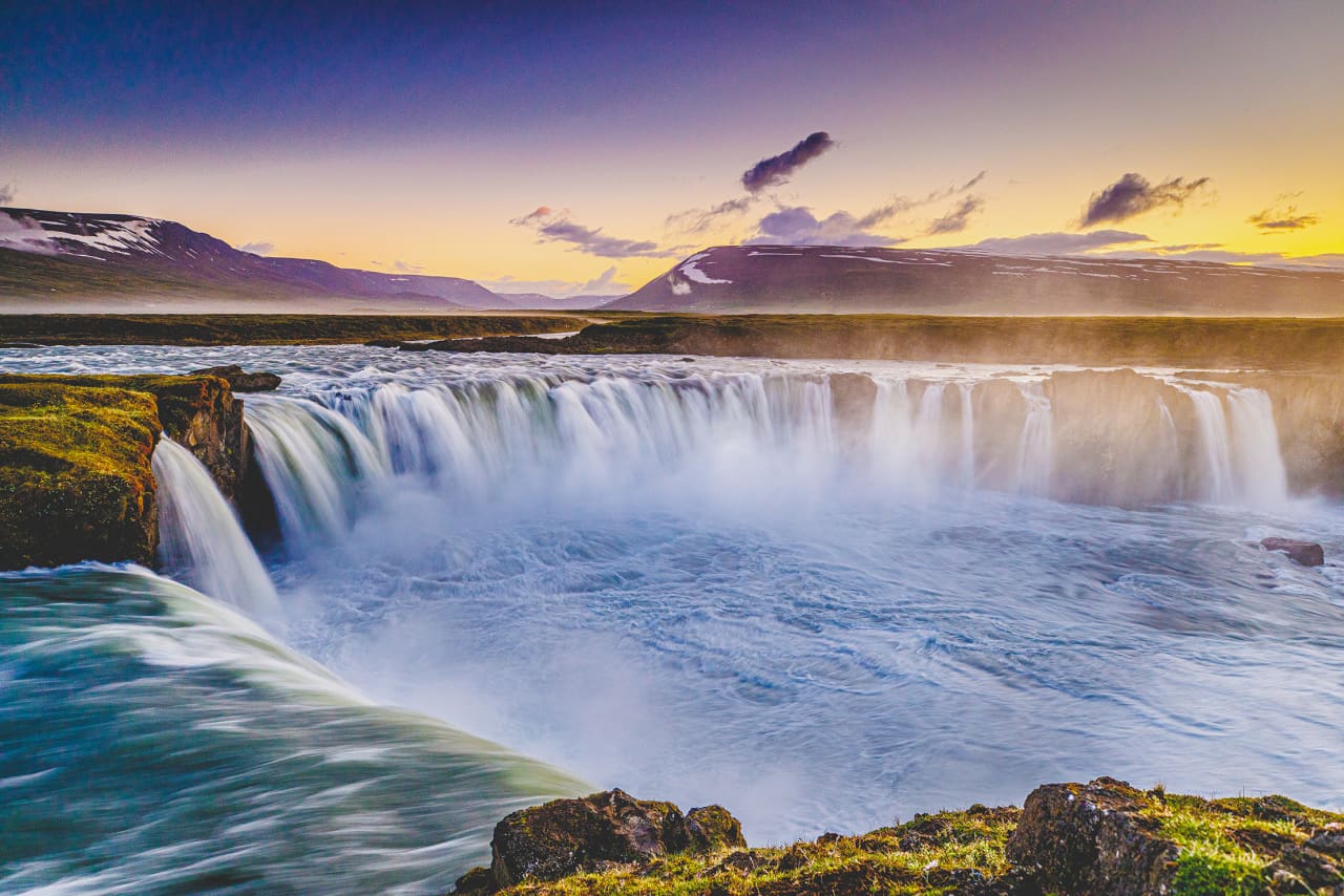
Skjálfandafljót begins in the Vonarskarð area between Vatnajökull and Tungnafellsjökull and travels roughly 180 kilometres to Skjálfandi bay. Meltwater is only part of its supply: runoff-fed streams and spring-fed tributaries join it across the northern Highlands. Aldeyjarfoss belongs to a connected river landscape that includes Hrafnabjargafoss upstream and Goðafoss farther downstream. The waterfalls mark different points along that journey from the interior towards the coast, with water from several kinds of source moving through the same river system.
Several lava flows beneath one landscape
Geologists distinguish three Bárðardalshraun lava flows in the valley. The 2023 NORDQUA field guide places Aldeyjarfoss on the youngest, which covers much of the valley floor almost towards the coast. The oldest and youngest flows are coarse-grained, while the middle one is finer-grained. Geochemical work summarized in the guide suggests an origin in the Bárðarbunga volcanic system. These lavas entered Bárðardalur near Svartárkot at the head of the valley. The broader setting is a valley about 45 kilometres long and two to three kilometres wide, with a relatively flat floor between steep, low hills.
How the basalt columns formed
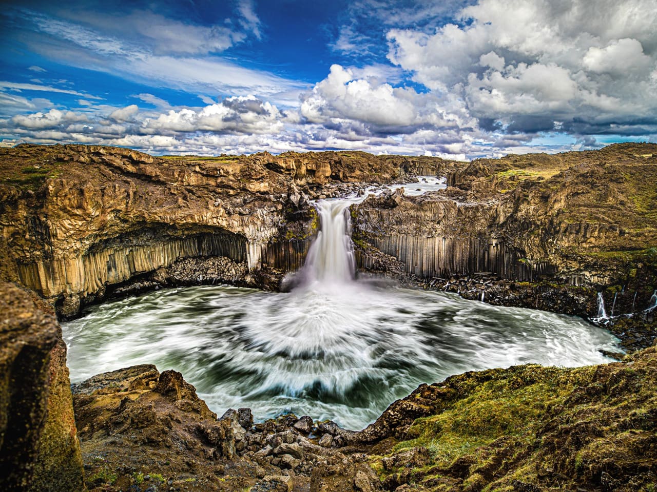
Columnar basalt forms when cooling rock contracts and fractures into polygonal pillars, often with six sides. The columns develop perpendicular to the surface through which heat is being lost, so their direction records the geometry of cooling. At Aldeyjarfoss, upright columns occur alongside radiating arrangements called stuðlarósir, or column rosettes. Their shape belongs to the lava's cooling history. Subsequent river erosion exposed the rock, allowing the waterfall's surroundings to show both the original fracture pattern and the later work of flowing water.
A sequence of contrasting waterfalls
Aldeyjarfoss drops just over 20 metres through a narrow opening into a horseshoe-shaped pool. Ingvararfoss lies immediately upstream and has a smaller drop. About five kilometres upstream from Aldeyjarfoss, Hrafnabjargafoss spreads across several channels over a much lower, broader step. Part of its western flow passes beneath a natural lava bridge. These contrasting forms occur where the river has cut into lava at the edge of the Highlands, producing a succession of falls rather than one continuous descent.
Natural heritage and the upper catchment
The catchment above Aldeyjarfoss has ecological significance beyond the gorge. Náttúrufræðistofnun identifies the river and its tributaries as an internationally important breeding area for pink-footed geese. Its landscape description includes vegetated valley bottoms, bare uplands and lava covered by windblown sand. A survey listed in the assessment recorded 4,724 breeding pairs in 2002: a historical count across the wider upper catchment, rather than at the waterfall itself. The waterfall sequence also appears in Iceland's natural heritage register, which identifies the river and its banks for their distinctive falls.
Access at the edge of the Highlands
Visit Akureyri describes the western approach through Bárðardalur onto F26, followed by a track to a parking area west of the river. A path descends from there to the lava around the falls. The final mountain-road section has no winter service. Access depends on road and weather conditions. Vegagerðin explains that snow cover and thawing ground affect mountain-road openings, and that projected opening dates are not guarantees. Its traffic service publishes current conditions on umferdin.is. Check that live information before setting out and follow any closures.
Article reviewed .